
Coyote Canyon -- Escalante Canyons -- April 2010
Trip Summary: We packed four "day" hikes and one four day backpack into this trip. We flew into Grand Junction Colorado on April 11th & drove to Escalante, Utah. Out of Escalante we did day hikes in Upper Escalante Canyon on 4/12 and to Phipps Arch on 4/13. The Upper Escalante Canyon day hike was a "feet wet" hike (a lot of it required walking in the river). For the Phipps Arch day hike we scouted out a dry route to the Arch (to avoid walking in the river) on the topo maps. Mark Saunto, who owns a guide service & gear shop in Escalante, was very helpful in giving us tips while planning out a route to Phipps Arch. The Phipps Arch day hike ended up being 12-14 miles. The morning after the Phipps Arch day hike we left Escalante and headed down the "Hole in the Rock" Road to begin our 4 day backpack in Coyote Gulch. We had to go about 34 miles down the Hole in the Rock Road, a dirt road, in our rental car along with Mark Saunto, who we hired to shuttle us from our exit point out of Coyote Gulch, to reach Hurricane Wash. Hurricane Wash was where we exited the canyon on the fourth day. After leaving the car at the end of Hurricane Wash, we piled into Mark's 1987 Chevy Suburban and headed to the point where we began our backpack in Coyote Gulch, at the end of Forty Mile Ridge Rd. Guide books and maps mark Forty Mile Ridge Road with the words "deep sand, drive fast", but it didn't seem that bad when we were there. From the end of Forty Mile Ridge Road we began the backpack into Coyote Gulch, having to drop off the rim of Escalante Canyon and hike to the mouth of Coyote Gulch (where Coyote Creek meets the Escalante River). Three of us did a side hike up part of the Escalante River to Stevens Canyon. We hoped to reach a Grotto and hanging Arch about 1 to 1.5 miles inside Stevens Canyon, but had to turn back just inside Stevens Canyon because it was getting too late in the afternoon. (It was slow going getting from the mouth of Coyote Gulch to Stevens Canyon because we had to either walk mostly in the Escalante River, which was waist deep in many areas with a swift current, or try and thrash through thick vegetation & tamarisk along the river banks. I also had a brief episode where I had to pull myself out of a patch of quicksand near the mouth of Stevens Canyon). For day two of the Coyote Gulch backpack we headed up the canyon and camped at Hamblin Arch. For day three we set up camp near the confluence of Hurricane Wash & Coyote Gulch and then, without our packs, hiked Sleepy Hollow (about 2 miles above the confluence with Hurricane Wash). The lower half of Sleepy Hollow was tricky to get through (choked with thick vegetation, reeds, trees & containing deep water pools). Day four of the Coyote Gulch backpack was just heading back to the car via Hurricane Wash. After getting back to the car we drove to the "dry fork" portion of Coyote Gulch, just off the Hole in the Rock Road, and hiked Peek-A-Boo slot. We then headed back to Escalante. The next day, the last day of the trip, we did a short day hike in Calf Creek Canyon to Lower Calf Creek Falls (6 miles round trip). After finishing the hike to Lower Calf Creek Falls we drove back to Grand Junction, CO (4/18) and flew home.
Regional Map with Coyote Gulch
(Coyote Gulch is just off "Hole in the Rock Road" north of Lake Powell)
(Coyote Gulch is just off "Hole in the Rock Road" north of Lake Powell)

PICTURED BELOW: Photo taken from Boulder Mountain (Dixie National Forest) between Torrey, Utah & Boulder, Utah (Escalante was the next town after Boulder). This was taken on Hwy 12 during the drive to Escalante. In the photo front to back are: Boulder Mountain, the red sandstone in Capitol Reef National Park (waterpocket fold) & the Henry Mountains

PICTURED BELOW: Ponderosa in Upper Escalante Canyon, between Pine Creek & Death Hollow

PICTURED BELOW: Upper Escalante Canyon, between Pine Creek & Death Hollow

PICTURED BELOW: Escalante River & remaining banks of snow, Upper Escalante Canyon

PICTURED BELOW: Upper Escalante Canyon, between Pine Creek & Death Hollow

PICTURED BELOW: Upper Escalante Canyon, between Pine Creek & Death Hollow

PICTURED BELOW: Ponderosa, Upper Escalante Canyon, between Pine Creek & Death Hollow

PICTURED BELOW: A good reference point on the topo early during the hike to Phipps Arch

PICTURED BELOW: A dry tinaja on the hike to Phipps Arch

PICTURED BELOW: Sandstone in the first of two dry washes we followed to reach Phipps Wash (which led to Phipps Arch)

PICTURED BELOW: A dry falls and water hole on the way to Phipps Arch - Notice the Coyote Tracks on the Left

PICTURED BELOW: On the hike to Phipps Arch

PICTURED BELOW: Canyon wall stained with streaks of desert varnish in Phipps Wash (on the way to Phipps Arch)

PICTURED BELOW: Phipps Arch

PICTURED BELOW: Phipps Arch

PICTURED BELOW: Phipps Arch

Map of Coyote Gulch Backpack - 4 days (April 14th through April 17th)

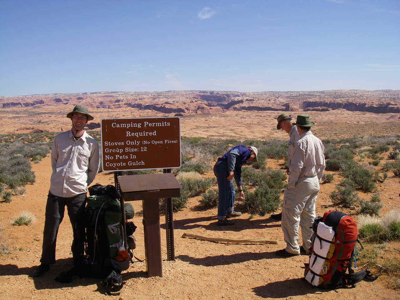
PICTURED BELOW:Me (at left) at the register at the end of Fortymile Ridge Road, the starting point of our Coyote Gulch backpack
PICTURED BELOW: Walking across slick rock towards the Escalante River Canyon rim - day 1 of Coyote Gulch backpack. In the distance are the Straight Cliffs of the Kaiparowits Plateau

PICTURED BELOW: Stevens Arch & the Escalante River Canyon from the canyon rim - day 1 of Coyote Gulch backpack

PICTURED BELOW: Descending off the canyon rim towards the "crack in the wall", the narrow passage that took us off the canyon rim to the top of a big sandy hill that leads to the mouth of Coyote Gulch - day 1 of Coyote Gulch backpack

PICTURED BELOW: James climbing into the upper part of the "crack in the wall" - day 1 of Coyote Gulch backpack

PICTURED BELOW: Me at the end of the "crack in the wall" (the third and narrowest of the three "cracks" that make up the route) - day 1 of Coyote Gulch backpack

PICTURED BELOW: Escalante River Canyon, Stevens Arch & a big rock fin on the way to the mouth of Coyote Gulch - day 1 of Coyote Gulch Backpack. In the deep part of the canyon (green area at lower right) is the Escalante River. You can also barely see Coyote Gulch intersecting the river from the left.

PICTURED BELOW: Lowering packs from the canyon rim - day 1 of Coyote Gulch backpack

PICTURED BELOW: After dropping through the "crack in the wall" off the rim - here we are making the rest of the descent to the mouth of Coyote Gulch & the Escalante River. The Escalante River is in the green area in the upper right of the photo. In this photo I'm the one out front (furthest away of the three people pictured), in the green hat & green/gray pack.

PICTURED BELOW: Descending into Coyote Gulch - In the distance (top center of photo) is Stevens Arch - day 1 of Coyote Gulch backpack

PICTURED BELOW: Stevens Arch - day 1 of Coyote Gulch backpack

PICTURED BELOW: Escalante River, between Coyote Gulch & Stevens Canyon - day 1 of Coyote Gulch backpack

PICTURED BELOW: Stevens Arch - day 1 of Coyote Gulch backpack

PICTURED BELOW: Inside Stevens Canyon - day 1 of Coyote Gulch backpack

PICTURED BELOW: Stevens Arch & walking in the Escalante River - day 1 of Coyote Gulch backpack

PICTURED BELOW: Night #1 campsite in Coyote Gulch, near the confluence with the Escalante River

PICTURED BELOW: small waterfall in Coyote Gulch - day 2 of Coyote Gulch backpack

PICTURED BELOW: Me (at center & closest in the photo) in Coyote Gulch - above the small waterfall - day 2 of Coyote Gulch backpack

PICTURED BELOW: Waterfall in Coyote Gulch - day 2 of Coyote Gulch backpack

PICTURED BELOW: Cliff Arch, in Coyote Gulch - day 2 of Coyote Gulch backpack

PICTURED BELOW: Lunch break - day 2 of Coyote Gulch backpack

PICTURED BELOW: Me with arms outstretched - underneath Coyote Natural Bridge - day 2 of Coyote Gulch backpack

PICTURED BELOW: Coyote Natural Bridge - day 2 of Coyote Gulch backpack

PICTURED BELOW: In Coyote Gulch - day 2 of Coyote Gulch backpack

PICTURED BELOW: Me in Coyote Gulch somewhere on the move between Camp One and Camp Two

PICTURED BELOW: Hamblin Arch & our night #2 campsite - Coyote Gulch

PICTURED BELOW: Getting water from the spring near Hamblin Arch

PICTURED BELOW: Big alcove near our night #2 campsite, Coyote Gulch (you can see someone in the group standing to the left of the tall tree)

PICTURED BELOW: Coyote Gulch - day 3 of Coyote Gulch backpack

PICTURED BELOW: Coyote Gulch & my group - day 3 of Coyote Gulch backpack

PICTURED BELOW: Coyote Gulch & my group - day 3 of Coyote Gulch backpack

PICTURED BELOW: Hamblin Arch, Coyote Gulch - day 3 of Coyote Gulch backpack

PICTURED BELOW: Coyote Gulch & my group - day 3 of Coyote Gulch backpack

PICTURED BELOW: Coyote Gulch - day 3 of Coyote Gulch backpack

PICTURED BELOW: Coyote Gulch - day 3 of Coyote Gulch backpack

PICTURED BELOW: Coyote Gulch & my group - day 3 of Coyote Gulch backpack

PICTURED BELOW: Night No. 3 campsite in Coyote Gulch - at confluence with Hurricane Wash

PICTURED BELOW: In Coyote Gulch, north of confluence with Hurricane Wash - day 3 of Coyote Gulch backpack

PICTURED BELOW: In Sleepy Hollow (tributary of Coyote Gulch) - day 3 of Coyote Gulch backpack

PICTURED BELOW: In Sleepy Hollow (tributary of Coyote Gulch) - day 3 of Coyote Gulch backpack

PICTURED BELOW: In Sleepy Hollow (tributary of Coyote Gulch) - day 3 of Coyote Gulch backpack

PICTURED BELOW: In Sleepy Hollow (tributary of Coyote Gulch) - day 3 of Coyote Gulch backpack

PICTURED BELOW: a nice "grassy knoll" in Sleepy Hollow (tributary of Coyote Gulch) - day 3 of Coyote Gulch backpack

PICTURED BELOW: In Sleepy Hollow (tributary of Coyote Gulch) - day 3 of Coyote Gulch backpack

PICTURED BELOW: Coyote Gulch, north of the confluence with Hurricane Wash

PICTURED BELOW: Cooking dinner at Camp Three (I'm the one in the blue long sleeve shirt).

PICTURED BELOW: Hiking back to the car in Hurricane Wash (day 4 of Coyote Gulch backpack- final day). In the distance are the Straight Cliffs of the Kaiparowits Plateau

PICTURED BELOW: Peek-A-Boo Slot (off "dry fork" of Upper Coyote Gulch)

PICTURED BELOW: Peek-A-Boo Slot (off "dry fork" of Upper Coyote Gulch)

PICTURED BELOW: Peek-A-Boo Slot (off "dry fork" of Upper Coyote Gulch)

PICTURED BELOW: Calf Creek Canyon

PICTURED BELOW: Me & Lower Calf Creek Falls

PICTURED BELOW: Fremont granary in side canyon of Calf Creek Canyon

PICTURED BELOW: Me overstating my excitement that I picked my way through a bunch of cactus to find this Fremont rock art - in side canyon of Calf Creek Canyon

PICTURED BELOW: Photo taken on the drive back to Grand Junction, CO on Hwy 24 somewhere between Caineville, Utah and Hanksville, Utah
