
Middle & West Forks of the Gila River - Gila Wilderness - New Mexico - April 2017

Trip Summary:
Dr. Bruce was the only one who was able to join me on this trip so on Easter Sunday I drove out to his place in Wimberley and we headed to New Mexico. The drive to Silver City, just outside the Gila Wilderness, took about eleven hours, with nine of those hours being the drive from Austin to El Paso. After a night in Silver City we took the very, very windy road north into the Gila Wilderness and a parking area at the Gila Cliff Dwellings National Monument. The Gila Cliff Dwellings National Monument protects a small set of cliff dwellings of the Mogollon culture, but we did not get a chance to see them because the gate to the monument’s trails was closed when we finished our five day hike. I was disappointed about that.
We hiked about 42 miles over 5 days - mostly through the lower half of the Gila River, Middle Fork canyon. Our intended route would have picked up the last nine or so miles of the West Fork of the Gila, but the “cross over” route proved to be a little sketchy and hard to follow, so not having packed my compass (never again), I decided to take an alternate route back to the car that was more straight forward. FYI to anglers: About 15-20 miles up the Middle Fork there are some deeper pools - full of trout.
The miles hiked up and down the Middle Fork proved to be slow going at times, with many crossings of the swift - knee to waist deep - water of the river (also containing large, slick boulders), scrambling through down timber & flood debris and trekking through brush and rocky shores of the stream. But the canyon scenery was fantastic, the weather was great, and the hot springs encountered during the second day out (“Jordan Springs”) was very cool. Also neat, but a little unnerving, was the sound of a mountain lion purring close by to us as we hiked on day two, just below the hot springs. I’ve got a picture of one of its tracks below. We got back to the car at around six in the evening on day five of the hike, so we couldn’t make the drive back home all in one day & spent a night on the road in El Paso.
Route Map (red) - Roughly 42 miles total

PICTURED BELOW: Debris from runoff/flood of the Gila River, Middle Fork

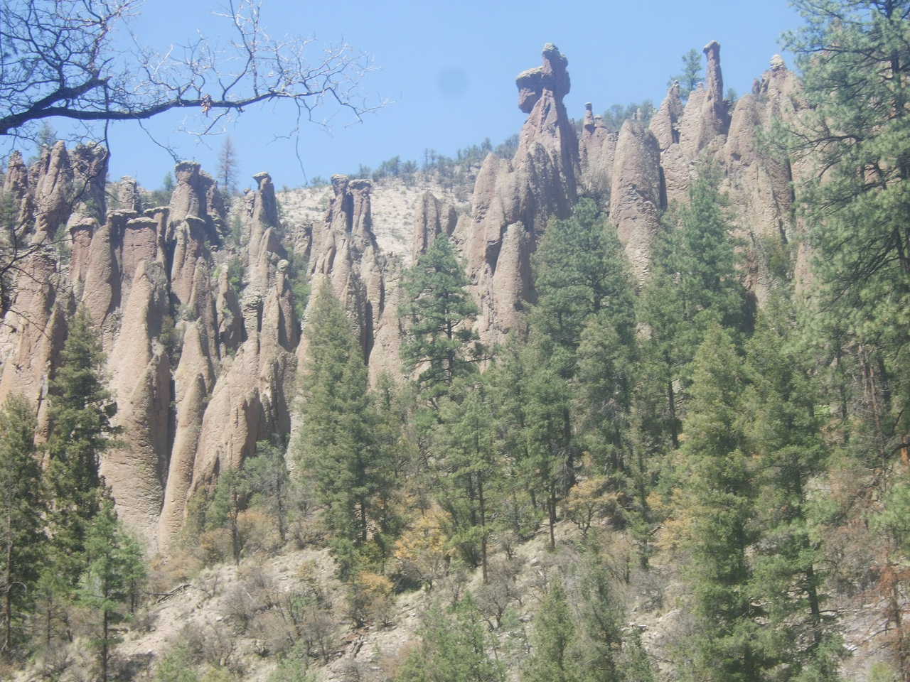
PICTURED BELOW: Hoodoos & Canyon of the Gila River, Middle Fork

PICTURED BELOW: Reddish walls of the canyon

PICTURED BELOW: Middle Fork, Gila River

PICTURED BELOW: mountain lion tracks. We heard this lion purring a short distance from these tracks, but did not see it.

PICTURED BELOW: Middle Fork, Gila River

PICTURED BELOW: Typical crossing the Gila - this route required crossing & recrossing the river, about 5-10 times per mile

PICTURED BELOW: hot springs pool on the Gila River Middle Fork ("Jordan Springs")

PICTURED BELOW: me in the hot springs pool

PICTURED BELOW: hot springs pool on the Gila River Middle Fork ("Jordan Springs")

PICTURED BELOW: Middle Fork, Gila River

PICTURED BELOW: Middle Fork, Gila River

PICTURED BELOW: Middle Fork Canyon walls

PICTURED BELOW: Middle Fork Canyon walls

PICTURED BELOW: nights #2 & #4 camp, in an area called "the meadows"

PICTURED BELOW: Middle Fork canyon

PICTURED BELOW: Middle Fork, Gila River

PICTURED BELOW: Hoodoos in the Gila River Canyon
PICTURED BELOW: Middle Fork, Gila River

PICTURED BELOW: Middle Fork, Gila River with James out front about to make another river crossing

PICTURED BELOW: night #3 camp

PICTURED BELOW: night #3 camp

PICTURED BELOW: Hoodoos & Pines, Middle Fork Canyon

PICTURED BELOW: Gila River & canyon just above "the meadows" (nights 2 & 4 camp). Some big pools above the meadows looked to contain a lot of trout.

PICTURED BELOW: At the end - the parking lot
