Trip Summary:
We Flew into Grand Junction Colorado on June 17th, landing at the airport during late morning, and drove to Escalante Utah (about a six hour drive). We arrived in Escalante at about 7 pm and stayed at an RV park/campground in Escalante. The next morning we headed into the Upper Escalante Canyon for a two day/one night out & back trip from the Escalante River gauging station to the mouth of Death Hollow. About four miles into the canyon the soles on my boots began to delaminate. Luckily one of the guys had a little duct tape to keep them together for at least a little while (sand & water working on that tape job would undo my repairs if I hiked more than a day in those boots) It was at about the half way point between the gauging station & Death Hollow that the Escalante River dried up. We found a place to set up our camp for the night at a location several hundred yards before the point where the river water ceased. At that point in the day I had already consumed all the water I had packed and, because of the heat, setting up a ‘dry’ camp further down canyon was not a good option. After we set up camp and refilled our water containers, we headed to Death Hollow. I had some sandals that I wore from camp to near the mouth of Death Hollow, but I had to stop and turn back to camp because the straps on one of my sandals broke. I was running out of footwear at this point. I did make it back to the camp in my broken sandals and enjoyed our night in the canyon. The next morning we saw that the portion of the river near our campsite, which was flowing the day & night before, had dried up. The Escalante River water was not very good. It tasted soft (a little soapy tasting). That morning we made the short hike out of Upper Escalante Canyon to the gauging station & then the town of Escalante. Luckily the little bit of tape I was able to wrap around the boots did hold them together for the hike out of Upper Escalante Canyon & back to the gauging station.
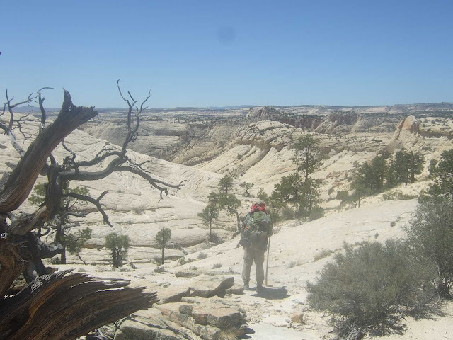
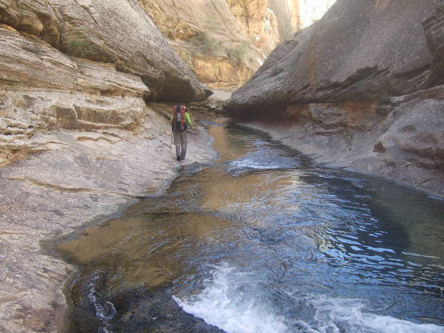
We stayed at the RV park/campground in Escalante after finishing the two day/one nighter in Upper Escalante Canyon. The next four days of the trip would be dedicated to the ‘main event’ – the four day/three night backpack covering the east half of the old Boulder Mail route, the lower half of Death Hollow and the portion of the Escalante River Canyon from the Death Hollow confluence to the Highway 12 bridge. I bought a big roll of duct tape at the grocery store in Escalante to keep my boots together for this backpack. I put fresh tape on them every morning. We got up very early (4:30 am) to head to the start of the route, which was at the Boulder air strip. We got such an early start because the Boulder Mail segment was on slick rock and the afternoon temperatures out there were hot. It was during the descent into Death Hollow from the Boulder Mail Route that the real heat of the afternoon started to hit. I had some pretty bad cramping issues with my legs during the descent, even though I had consumed about a gallon of water during the day’s hike. The bottom of Death Hollow Canyon contained thick vegetation in places, tall ponderosa pine trees, towering walls of white, yellow, red, orange & patterned Navajo sandstone (Jurassic aged deposition) and a nice, but deep in places, stream of cold great tasting water. There was also quite a bit of poison ivy in the canyon that had to be avoided. Our night one campsite was close to where we descended into the canyon. There was a large pool at our campsite. We all took a long swim in that pool. Our night two campsite was at the confluence of Death Hollow & Maime Creek. There was a good swimming hole at that campsite as well. Our night three campsite was at the confluence of Death Hollow & the Escalante River canyon. It was a few miles before we reached our night three camp that we encountered the deepest water within Death Hollow. There were several potholes that we had to go through that contained water over our heads in some places. However, we were able to traverse some ledges at the bottom of those potholes which put the water at waist or chest deep.
After our six days of backpacking the Escalante River Canyon & Death Hollow (the two day out & back in Upper Escalante Canyon plus the four day Boulder Mail/Death Hollow/Escalante River Canyon hike) we headed to Torrey Utah. We ate dinner at a very good restaurant in Torrey, next to the RV park/campground where we spent the night. The next day we went to Capitol Reef National Park and spent the day there. After leaving Capitol Reef National Park we headed to Green River Utah, where we spent the night at a KOA. After the night at the Green River KOA we made the short drive back to Grand Junction CO, where we caught our flight home.
June 18th through June 19th Route
Route is marked in red (lower left of map below) with camp identified for night of June 18th
PICTURED BELOW: The closest thing to an 'arch' that we saw over the first few days; Upper Escalante Canyon
PICTURED BELOW: Taking a break in a massive alcove; Upper Escalante Canyon
PICTURED BELOW: Taking a break in a massive alcove; Upper Escalante Canyon
PICTURED BELOW: Upper Escalante Canyon
PICTURED BELOW: Upper Escalante Canyon
PICTURED BELOW: Upper Escalante Canyon
PICTURED BELOW: Our primitive camp 'kitchen'; Upper Escalante Canyon
PICTURED BELOW: Upper Escalante Canyon
June 20th through June 23rd Route
Route is marked in red with camp locations also shown
PICTURED BELOW: Warning to the unseasoned backpacker; Grand Staircase Escalante National Monument
PICTURED BELOW: The start of this four day backpacking route into & through Death Hollow was at the Boulder Utah Airstrip. Here is the trusty windsock at the runway for anyone who actually attempts to land here. The inscription below it reads "Airport and UFO Landing Site". You are more likely to see a UFO land at this crappy airstrip than an actual airplane
PICTURED BELOW: This was our first view of Death Hollow -- five or so miles away from the rim
PICTURED BELOW: On the Boulder Mail Route
PICTURED BELOW: Remnants of the old telegraph line that followed the Boulder Mail Route
PICTURED BELOW: Near the rim of Death Hollow
PICTURED BELOW: Near the rim of Death Hollow
PICTURED BELOW: Paul out in front - Near the rim of Death Hollow
PICTURED BELOW: Paul at the rim of Death Hollow
PICTURED BELOW: Death Hollow - looking north
PICTURED BELOW: Me - along the rim of Death Hollow during the descent. This was right after I traversed that narrow ledge of about 1-1/2 to 2 feet wide & 50-60 yards long with the 600 foot drop. Shortly after Paul took this photo of me my legs completely cramped up and I collapsed under the tree in the right of the photo. Even after twenty or thirty minutes of recovery, I felt very wobbly making the rest of the steep ascent into the canyon. The worst of the exposure was over, though.
PICTURED BELOW: Death Hollow - looking down-canyon
PICTURED BELOW: Looking back up at the portion of the descent with the scariest exposure.
PICTURED BELOW: Me - feeling a little whipped - about to take a swim in the creek at our night #1 campsite within Death Hollow
PICTURED BELOW: Picture from our night #1 campsite within Death Hollow
PICTURED BELOW: Picture of our night #1 campsite (and one of the tents) within Death Hollow
PICTURED BELOW: Picture of our night #1 campsite (and one of the tents) within Death Hollow
PICTURED BELOW: Death Hollow
PICTURED BELOW: Death Hollow
PICTURED BELOW: Death Hollow; near confluence with Maime Creek
PICTURED BELOW: Our Night #2 campsite within Death Hollow
PICTURED BELOW: Our Night #2 campsite within Death Hollow
PICTURED BELOW: A very still, large pool near a pour-off within Maime Creek canyon
PICTURED BELOW: Death Hollow
PICTURED BELOW: Death Hollow
PICTURED BELOW: Death Hollow
PICTURED BELOW: Death Hollow - at the beginning of some deep potholes (at least neck deep)
PICTURED BELOW: Death Hollow - at the beginning of some deep potholes (at least neck deep)
PICTURED BELOW: Bill way out front within some nice narrows - Death Hollow
PICTURED BELOW: Bill out front in some nice narrows - Death Hollow
PICTURED BELOW: Negotiating through another deep pool - Death Hollow
PICTURED BELOW: In an alcove eating lunch - Death Hollow
PICTURED BELOW: Paul out front - Death Hollow
PICTURED BELOW: Paul taking a break - Death Hollow
PICTURED BELOW: Death Hollow
PICTURED BELOW: Death Hollow
PICTURED BELOW: Our campsite at the Death Hollow/Escalante Canyon confluence
PICTURED BELOW: My pack ready to go during the fourth morning in Death Hollow/Escalante Canyon
PICTURED BELOW: Escalante Canyon
PICTURED BELOW: Escalante Canyon
PICTURED BELOW: Escalante Canyon
PICTURED BELOW: Escalante Arch - Escalante Canyon
PICTURED BELOW: Escalante Natural Bridge - Escalante Canyon
PICTURED BELOW: Six days worth of damage & duct tape repairs to my canyon/river boots - This was thier last trip.
PICTURED BELOW: Our campsite at an RV park in Torrey, Utah
PICTURED BELOW: Visitor Center in Capitol Reef National Park
PICTURED BELOW: Capitol Reef National Park
PICTURED BELOW: Fremont Hand Print (700 to 1,300 AD); Capitol Reef National Park
PICTURED BELOW: Fremont Rock Art (700 to 1,300 AD); Capitol Reef National Park


