
Trip Summary: I flew into Spokane, WA and caught Amtrak's "Empire Builder", which runs from Seattle to Chicago and took the train from Spokane to the east side of Glacier National Park (about a 9 hour trip), where I met the rest of the group. The rest of the group had spent the previous week backpacking in Grand Tetons National Park. We did a four day/three night backpack in the Two Medicine area of the park (camping at Cobalt Lake, No Name Lake and Old Man Lake) and spent the final day doing a very, very long off trail hike on the west side of the park from Logan Pass, to Hidden Lake, over the Continental Divide, up to and around Sperry Glacier, over Comeau Pass and then to Lake McDonald. The next day I left the group, after breakfast in West Glacier, and took shuttles back to the east side of the park to the East Glacier Amtrak Station (there are three Amtrak stops in Glacier National Park: at West Glacier, at Essex and at East Glacier). From there I took the train back to Spokane and flew home.
PICTURED BELOW: Me in the lobby of Glacier Park Lodge (one of six lodges in the park) near East Glacier Village

PICTURED BELOW: Me in front of Two Medicine Lake & Sinopah Peak; Glacier National Park

PICTURED BELOW: The group at Two Medicine Lake before beginning the backcountry part of the trip (from left: Bill, Skipper, Me & James)

PICTURED BELOW: Hiking towards Cobalt Lake on the trail located on the south shore of Two Medicine Lake

PICTURED BELOW: James & Skipper at Rockwell Falls; Glacier National Park

PICTURED BELOW: Upper North Fork of Paradise Creek; Glacier National Park

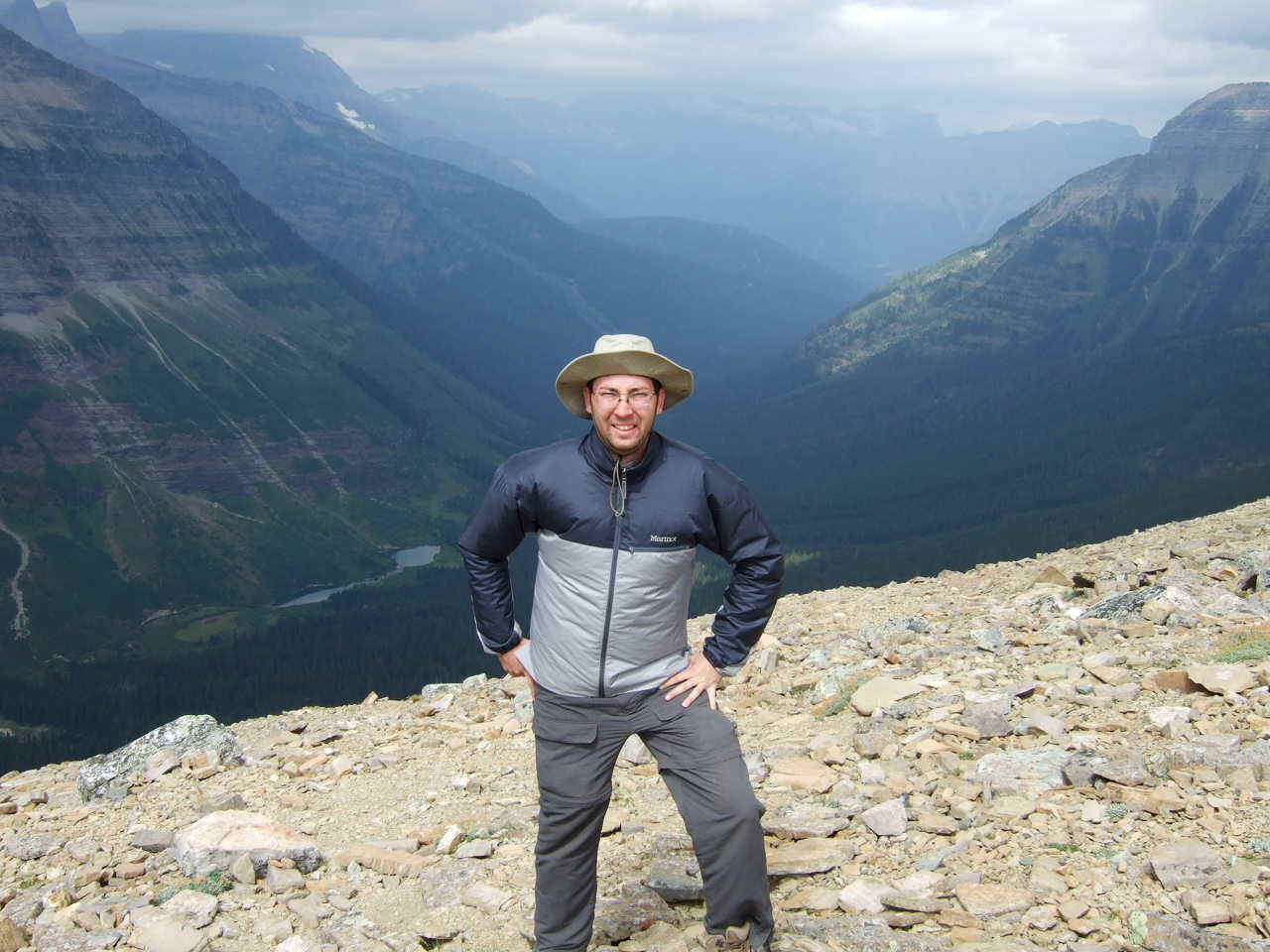
PICTURED BELOW: Sinopah Ridge from food prep. area at Cobalt Lake Campsite; Glacier National Park

PICTURED BELOW: Mt. Rockwell from Cobalt Lake (Mt. Rockwell Elevation is 9,272 ft.); Glacier National Park

PICTURED BELOW: Cobalt Lake & Bill reading on a rock slab (it's about 1,100 feet from the lake to the top of the cirque shown in this photo)

PICTURED BELOW: Skipper at the tent site of our Cobalt Lake campsite

PICTURED BELOW: High above Cobalt Lake from Chief Lodgepole Peak; Glacier National Park

PICTURED BELOW: View of Paradise Park Valley with Two Medicine Lake in the background from Chief Lodgepole Peak; Glacier National Park

PICTURED BELOW: No Name Lake; Glacier National Park

PICTURED BELOW: Big Horn Sheep (group of females and immature males) at Dawson Pass; No Name Lake and the upper end of Two Medicine Lake are also in this photo

PICTURED BELOW: Me at Dawson Pass above the Nyack Creek Valley; Glacier National Park
PICTURED BELOW: Old Man Lake; Glacier National Park

PICTURED BELOW: Me above Old Man Lake (in far background is Red Mtn. and in the foreground is Pitamakin Ridge)

PICTURED BELOW: At right is Pitamakin Lake & at left is Lake of the Seven Winds; taken from Pitamakin Ridge; Glacier National Park

PICTURED BELOW: James, Me and Bill hiking on Pitamakin Ridge; Glacier National Park (at center is Red Mtn.)

PICTURED BELOW: Old Man Lake and Flinsch Peak; Glacier National Park

PICTURED BELOW: Me on the way down to Old Man Lake; Glacier National Park

PICTURED BELOW: Tent site at Old Man Lake Campsite

PICTURED BELOW: shore of Old Man Lake

PICTURED BELOW: Scenic Point Mtn.; Glacier National Park

PICTURED BELOW: Me at a trail sign near Two Medicine Lake; Glacier National Park

PICTURED BELOW: Bearhat Mtn. and Hidden Lake; Glacier National Park

PICTURED BELOW: Hidden Lake & Clements Mtn.; Glacier National Park

PICTURED BELOW: Hidden Lake; Glacier National Park

PICTURED BELOW: Above Hidden Lake near the Continental Divide; Glacier National Park

PICTURED BELOW: View of Sperry Glacier from the Continental Divide; Glacier National Park

PICTURED BELOW: The flowers are fireweed. The lake is Mary Baker Lake. Also shown are Sperry Glacier, Gunsight Mtn., one of the three waterfalls coming off Gunsight Mtn., and Comeau Pass (the "V" shaped notch in the mountains in the upper right side of the photo). We hiked around Sperry Glacier to Comeau Pass, although it took another 10 miles of hiking to get back to the car at McDonald Lake

PICTURED BELOW: Small lake of water right below Sperry Glacier; Glacier National Park

PICTURED BELOW: Looking back at Bearhat Mtn. (left) and Reynolds Mtn. (right) from near Sperry Glacier (It is from the steep green slope in the center of the picture coming off the divide where we had crossed the divide from Hidden Lake and where I took the picture in the patch of pink fireweed of Mary Baker Lake)

PICTURED BELOW: Alison & I Heading up a snow bank to Comeau Pass
