Trip Summary:
I met up with the group in Grand Junction, Colorado and we drove to Canyonlands National Park together, staying the first night at the Squaw Flat Campground within the Needles Area of the park. The next morning we had a hired shuttle driver take us down the long dirt road to the starting point of our 5 day backpacking trip through Salt Creek Canyon. This was a very scenic canyon with a perennial creek running through most of its course. The highlight of the trip, however, were the ruins and rock art from the Anasazi and Fremont cultures that can only be accessed by multi day hikes. Coming across a patch of squash plants on the second day of our hike still growing in a side canyon next to a set of grainery ruins, knowing they were there there due to the handiwork of these ancient cultures, was also very cool. Angel Arch was also very memorable. On the morning of the third day in the canyon we got up before sunrise and walked a few miles (in the dark with our headlamps on) down the side canyon containing Angel Arch so we could watch the sun rise on the arch. It made for a great memory. After the 5 day backpack through Salt Creek Canyon we stayed at a small private campground just outside the entrance to the needles section of the park called "The Outpost". The next day we day hiked a popular area in the Needles District of Canyonlands NP called the Chesler Loop. After leaving Canyonlands the next morning, we drove back to the Moab, Utah area and spent half a day in Arches National Park, hitting up the most popular area - called "Devils Garden". It was worthwhile to do, but after the solitude of Salt Creek, the crowds at Arches National Park made it seem like Disneyland. It made me wish I could have experienced the place when it was a seldom visited National Monument like Ed Abbey described. After spending the afternoon at Arches, we headed back to Grand Junction and parted ways.
If you go: best references are David Day book "Canyonlands National Park Favorite Jeep Roads & Hiking Trails"; the Falcon Guide on Canyonlands (the Day book is much better); or the out of print Michael Kelsey Canyonlands reference book if you can find it. Topos of Salt Creek drainage you should use (USGS Quadrangles): 1) Cathedral Butte; 2) South Six-shooter Peak & 3) Druid Arch; or Trails Illustrated makes a good map of Canyonlands National Park.
PICTURED BELOW: Me in front of Newspaper Rock
"Newspaper Rock State Historic Monument is located some 25 miles (40 km) north and west of Monticello and south and west of Moab in eastern Utah, western United States. The Monument features a flat rock with one of the largest known collections of petroglyphs. The petroglyphs were carved by Native Americans during both the prehistoric and historic periods. Some glyphs depict riders on horses. While precisely dating the rock carvings has been difficult, repatination of surface minerals reveals their relative ages. The reason for the large concentration of the petroglyphs is unclear, making the rock somewhat of a mystery. The location is near a stream and trail in an area with long expanses of otherwise impassable vertical cliffs. The carved face is located along State Route 211, the access road to Canyonlands National Park Needles District." (Wikipedia)

PICTURED BELOW: Descending into East Fork of the Salt Creek Canyon from Cathedral Butte (at the base of the Abajo Mountains); just outside Canyonlands National Park

PICTURED BELOW: Me at the National Park Boundary in Salt Creek Drainage

PICTURED BELOW: Hand Outlines done by Anasazi (dated anywhere from 250 AD to 1,350 AD) we saw during day one of hike through Canyon (near marsh @ head of Canyon)

PICTURED BELOW: Abandoned cabin of Rensselear Lee Kirk, who ranched in the Salt Creek Canyon from 1890 to 1905 (remnants of his wagon were on the other side of the cabin)

PICTURED BELOW: what's left of R.L. Kirk's wagon

PICTURED BELOW: Campsite for first night

PICTURED BELOW: Doing some rock scrambling during the first day

PICTURED BELOW: Anasazi ruins (dated 250 AD to 1,350 AD); although the Canyon was filled with granary ruins - this is the largest set of structures we found (Skipper & I explored it during day two and the next four pictures below are of some of the artifacts we saw at the base of these ruins)

PICTURED BELOW: Anasazi milling stones we found at the base of the big ruins

PICTURED BELOW: Another set of Anasazi milling stones we found at the base of the big ruins

PICTURED BELOW: Shards of Anasazi pottery we saw at the base of the ruins. The ground on the left side of the ruins was covered with hundreds and hundreds of pieces of pottery shards (no pieces I saw were bigger than a few inches)

PICTURED BELOW: More Shards of Anasazi pottery

PICTURED BELOW: Close up shot of some of the ruins

PICTURED BELOW: Salt Creek Canyon (during day two); Canyonlands National Park

PICTURED BELOW: Wedding Ring Arch; during day two; Salt Creek Canyon

PICTURED BELOW: Fisheye Arch (during day two); Salt Creek Canyon

PICTURED BELOW: Salt Creek Canyon; Canyonlands National Park

PICTURED BELOW: Anasazi Art (dated 250 AD to 1,350 AD); located in a small cave in the eastern canyon wall of Salt Creek (seen during day two of hike). This painting is about six feet tall. You can also see red handprints to the lower right of the painting and some to the right of the head. A set of dwelling ruins were also located in this cave.

PICTURED BELOW: Freemont Rock Art (near an unnamed good flowing spring), seen during day two in Salt Creek Canyon (these are at least 700 years old)

PICTURED BELOW: Me in front of the Fremont Art panel and ruins of a dwelling or granary

PICTURED BELOW: Crossing Salt Creek at a very accessible point (this is where we filled up on water after day two). We set up our tents for night two about 200-300 yards from this point

PICTURED BELOW: Taken from our night two campsite; Salt Creek Canyon

PICTURED BELOW: Our night two campsite in Salt Creek Canyon (you can see one of the tents and some of my group in the lower part of the picture). I climbed up on a big rock to take this one.

PICTURED BELOW: Paul, Bill, Me & Alison preparing to have dinner at night two campsite.

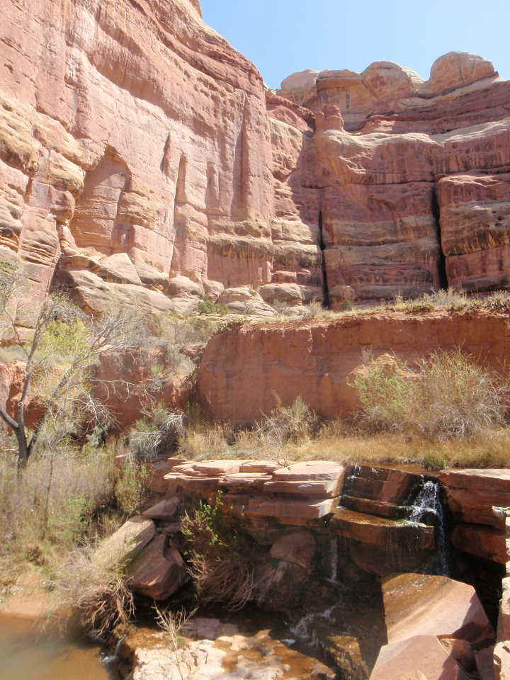
PICTURED BELOW: The "Upper Jump"; Salt Creek Canyon (taken during day three)

PICTURED BELOW: Alison at the Upper Jump

PICTURED BELOW: The Upper Jump
PICTURED BELOW: Salt Creek Canyon (during day three)

PICTURED BELOW: Angel Arch; located about 1-1/2 miles up a side canyon splitting from Salt Creek Canyon. We walked to this before sun rise so we could see the sun rise on the arch on the morning of day four.

PICTURED BELOW: Paul, Alison & I (below and to the left of the large balanced rock) watching the sun rise on Angel Arch

PICTURED BELOW: Angel Arch

PICTURED BELOW: Salt Creek Canyon (during day four)

PICTURED BELOW: From left: Me (green & gray pack), Alison, James & Paul (blue hat) walking towards a hole in one of the rock fins in Salt Creek Canyon, near Peekaboo Spring during day five (final day in Canyon)

PICTURED BELOW: Fremont Indian Art Panel (at least 700 years old) seen on day five near Peekaboo Spring (near upper end of Salt Creek Canyon). You can't really see it in this picture but this Fremont Art was painted over a large faded reddish figure that was painted by the Archaic People and could be as many as 8,000 years old. It was clearly visible when I was standing there looking at it, but none of the pictures I took could really pick it up.

PICTURED BELOW: Scorpion along the Chesler Loop trail

PICTURED BELOW: 11 mile Chesler Loop trail; Needles District; Canyonlands National Park, a day hike we did after getting out of Salt Creek Canyon, which is on the southern end of the park

PICTURED BELOW: Chesler Loop trail; Needles District; Canyonlands National Park

PICTURED BELOW: "Chesler Park"; Needles District; Canyonlands National Park

PICTURED BELOW: "Chesler Park"; Needles District; Canyonlands National Park

PICTURED BELOW: "Chesler Park"; Needles District; Canyonlands National Park

PICTURED BELOW: "Chesler Park"; Needles District; Canyonlands National Park

PICTURED BELOW: Walking through a joint; Chesler Loop

PICTURED BELOW: "Chesler Park"; Needles District; Canyonlands National Park

PICTURED BELOW: Portion of Elephant Canyon from the Chesler Loop trail; Needles District; Canyonlands National Park

PICTURED BELOW: "Chesler Park" trail; Needles District; Canyonlands National Park

PICTURED BELOW: "Chesler Park" trail; Needles District; Canyonlands National Park

PICTURED BELOW: Me in front of Delicate Arch; Arches National Park; Utah (last day of trip)

PICTURED BELOW: Landscape Arch; Arches National Park

PICTURED BELOW: Looking across large series of rock fins from on top of a fin; Devils Garden Area; Arches National Park

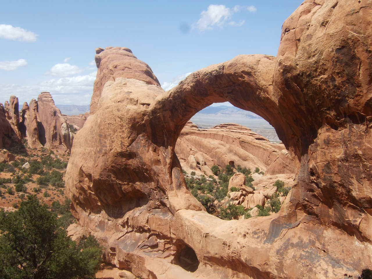
PICTURED BELOW: Double O Arch in Devils Garden; Arches National Park
PICTURED BELOW: View of the snow capped La Sal Mountains from Devils Garden in Arches National Park

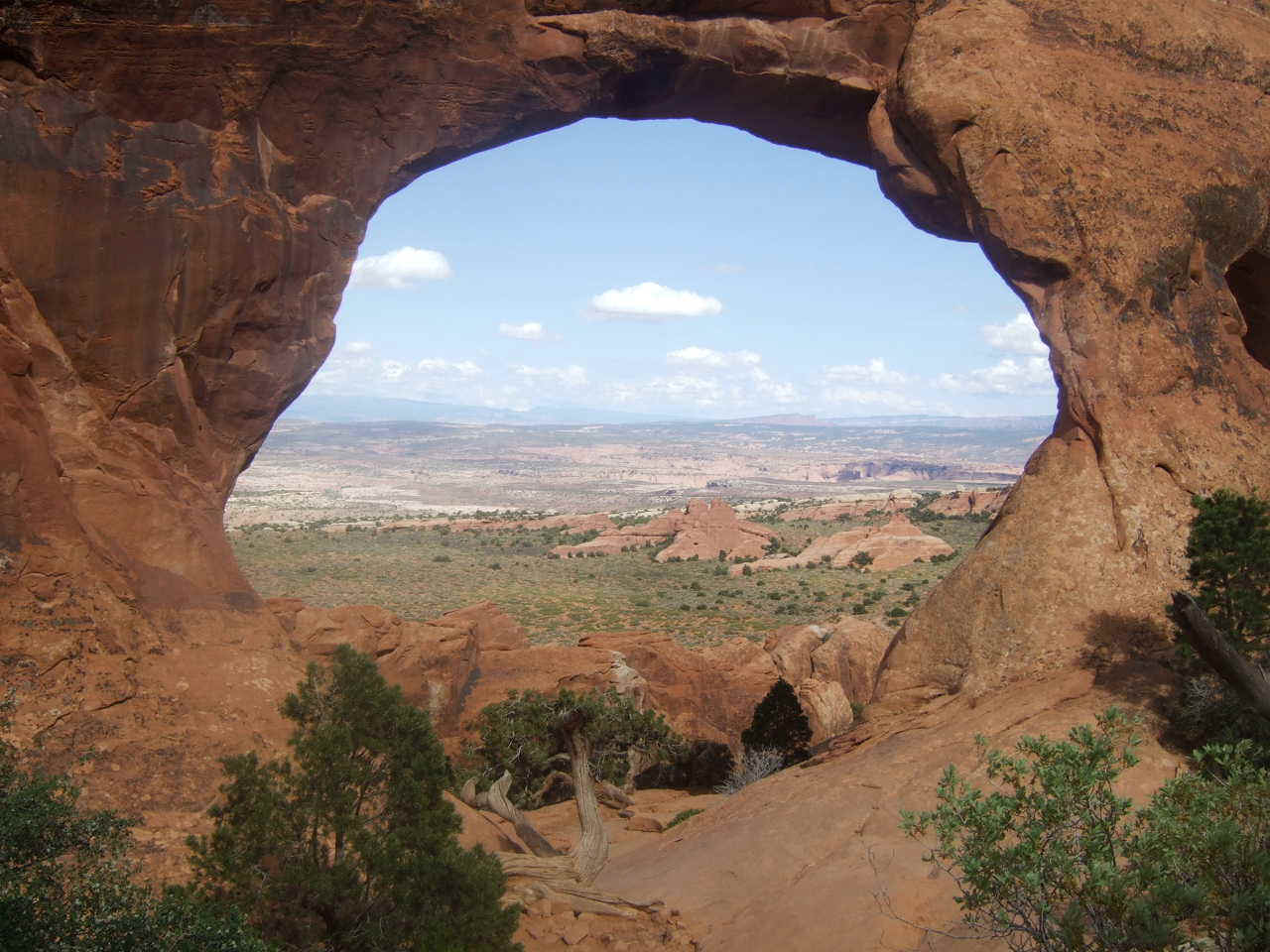
PICTURED BELOW: Looking through Partition Arch; Devils Garden; Arches National Park