Absaroka-Beartooth Wilderness & Yellowstone River Valley, Montana

A long overdue trip back to the mountains. That’s what this trip was. And travel time lost to COVID was more than made up for with a near perfect trip. James, Katie and Elizabeth joined me on this Montana adventure that was broken into two parts. The first part was the main purpose of the trip, a four-night backpack in the Absaroka-Beartooth Wilderness on a forest service trail dubbed “the beaten path”. The second part was spent camping, relaxing and doing a little hiking in the Yellowstone River Valley on the far northwestern corner of Yellowstone National Park. Unlike the longer milage required to complete the beaten path in the Beartooths, our camp on the Yellowstone River required only a 4 mile hike in.
The four of us met up at the
airport and flew to Bozeman on Sunday, August 29th. After an
overnight at a Bozeman motel we had a three hour drive to the Clarks Fork trailhead,
which is where we would exit the beaten path. The drive to the trailhead took us
through Gardiner Montana and the northwest corner of Yellowstone National Park.
During the part of the drive within Yellowstone we saw a wolf and several large
herds of buffalo that were very close to the road. That was pretty cool. Prior to the trip Katie had
found on Facebook a lady that ran a shuttle service for mountain bikers in the
area around Red Lodge & Cooke City. Luckily for us Katie was able to make arrangements
for us to use the lady’s shuttle service for our backpacking trip in the area. So, after grabbing lunch in Cooke City MT, we met the shuttle lady at the Clarks Fork trailhead (the exit point of our backpack
on the beaten path), left our rental car there, and enjoyed the 3 hour drive from
Clarks Fork to East Rosebud Lake, which included a long stretch on the amazingly
scenic Beartooth Highway. Getting to East Rosebud Lake also required a long stretch
on a decent dirt road that followed East Rosebud Creek. At East Rosebud Lake
was a small forest service campground, some privately owned cabins and the trailhead
for the beaten path.
The five days we spent on the
Beaten Path were amazing. The scenery was incredible and the weather was
perfect – not a hind of rain the entire time. There was, however, quite a bit
of smoke in the air from the wildfires in Oregon and California. It looked like
smog and you could smell it. Despite the hazy conditions from the smoke, there
were times when the air looked clearer and I could take some decent pictures. We
passed a few groups of other backpackers during our five days on the beaten
path, but we never saw anyone else anywhere close to the four lakes we camped
at during our time on the trial: Elk Lake, Echo Lake, Fossil Lake and Rock Island Lake. The
route started at an elevation of around 6,000 feet at East Rosebud Lake, topped
out at about 10,200 feet at Fossil Lake (our night 3 camp), and then descended
to about 8,000 feet at the Clarks Fork trailhead exit point, where we had left the car.
We got back to the car left at
Clarks Fork around mid morning on Friday, September 3rd.
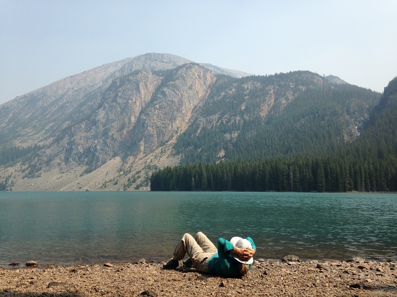
We then drove to the Blacktail Trailhead located in the northwest corner of Yellowstone
NP to hike the 4 miles into the Yellowstone River Valley, where we would camp
and hang out for the weekend (Labor Day weekend) before heading back home on Sunday
evening. The weather remained perfect through the weekend and we had a nice
relaxing weekend camping on the Yellowstone River. I did hike a few miles down
the Yellowstone River while we were there and had a very close call with a Prairie
Rattlesnake. After climbing up a steep and very rocky part of the trail while
heading back to our camp, I nearly stepped on a large yellowish rattlesnake
coiled up on the trail. When I got to the top of the rocks I caught the glimpse
of a diamond shaped snake head jerk towards me and heard the rattling noise. About
three feet away was that coiled up rattlesnake with his head raised up in the air like a cobra ready to
strike and that tail rattling like crazy. I was very startled and fell to the
ground when I took a step back. Luckily he didn’t strike, but could of very easily, being only about 3
feet away. I was able to stand up and slowly walk back and around him, getting
back to camp just fine.
We hiked out of our Yellowstone River camp early Sunday morning and made the drive back to Bozeman. Before leaving Yellowstone we stopped at the Mammoth Hot Springs. The place was just packed with tourists. After all the great experiences we had had in the Beartooth Wilderness and along the Yellowstone River over the previous week, I was not really enjoying being amongst the crowds of tourists at the Hot Springs. We were able to stop and get cleaned up at a Laundromat in Gardiner, where they had some fairly nice pay showers. After that we spent the afternoon in Bozeman, having a nice big meal and ducking in and out of some of the places along the main street, which had a ton of other tourists and college students doing the same thing. After we had our fill of Bozeman’s touristy and fun main street we headed to the airport and flew home.