Fifty Mile Creek, Davis Gulch, Willow Gulch and Forty Mile Gulch, Grand Staircase-Escalante National Monument & Glen Canyon National Recreation Area, Utah -- April/May 2023
Trip Summary:
The Canyons of the Escalante
River. They are a remarkable network of
canyons that are tributaries of Glen Canyon, a spectacular canyon in the heart of the Colorado River that by and large has been buried for nearly six decades under
what is now Lake Powell. Lovers of the lake will say that most of the stunning canyons within Glen Canyon are still there – just the very bottoms of those
canyons are submerged - but the top parts are still there for everyone to enjoy
and, besides, they are much easier now for people to access by boat than they ever were on foot or by technical canyoneering. No person that has spent a few days and at least a few nights in an unspoiled canyon of
the Escalante River or some other canyon in the area that has not been
smothered by the lake should be able to agree with that opinion. Canyons inundated
with lake water, when not filled with the noise of motorboats and jet skis, are
quiet, dead places that do have some beauty, but in reality are just a vestige, a corpse of what used to be.
Spend a few days and nights in
the canyons of the Escalante and you will get to experience all of the amazing things lost
when Glen Canyon Dam backed up the Colorado River and created Lake Powell - towering
red rock alcoves and arches, waterfalls, bright green benches full of plants
and trees, birds, insects and lizards, beautifully carved streams and plunge pools
within slick rock creek bottoms. At night the canyons are filled with the
soothing sounds of a gentle creek running, the rustling of cottonwoods, frogs and insects chirping and above all, brilliant night skies and solitude. The stench of a stagnant
lake is nowhere around! Over the past fifteen years I’ve done several trips to these
canyons and regardless of whatever physical discomfort and pain comes with exploring
them, I’m always left in complete awe and a strong desire to return.
This year I decided to hit up four
canyons in the lower portion of the Escalante River, canyons that have been opened up to a much greater degree in recent years due to historically low water levels in
Lake Powell. James Bruce and Matt Kincaid joined me on this weeklong trip,
although Matt would meet up with James and I during the midway point of the week. James and
I flew from Austin to Las Vegas early in the morning on Friday, April 28th and
drove the roughly five hours to Escalante, Utah. In Escalante, we stopped for
lunch and also completed the mandatory visit to the Escalante Interagency Visitor Center to
pick up our free camping & backpacking permit. From Escalante it was about an hour
and a half drive down the Hole in the Rock Road to get to the area of the four canyons that we would be
exploring that week.
We camped the first night near
Sooner Wash, in an area called Sooner Rocks, just a few miles away from where we
would start our adventure with the first canyon, Fifty Mile Creek. The first part of this trip was a four-day loop hike
of Fifty Mile Creek Canyon and Davis Gulch. We set a camp in the middle part of
Fifty Mile Creek Canyon and hiked the lower part of that canyon, which contains some extremely spectacular narrows, especially when the water in Lake Powell is
low. We then climbed out of Fifty Mile Canyon and hiked over to Davis Gulch to the
south, following a climb out and overland route that I had scouted out
beforehand from topo maps and satellite images. We camped two nights in Davis Gulch, spending the ‘layover’ day heading
upcanyon towards Bement Arch. That ended up being a little bit of a disappointing
day however, as the stream in Davis Gulch is choked full of brush and bamboo. It’s
a complete thicket that can be very slow and exhausting to navigate and slither through. So
we didn’t get to explore as much of Davis Gulch as I would like to have.
Unfinished business for sure. We then completed the loop on day four (May 2nd)
by navigating across open desert sand and rolling slick rock, and part of Hole
in the Rock Road, to get back to the car.
Just before the midweek point, on the evening of May 2nd,
Matt completed his long drive from Denver and joined up with James and I at the
Sooner Rocks area, where we car camped. The next morning we headed into nearby
Willow Gulch. The plan for Willow Gulch was an “out & back” hike over three
days, with the middle day spent exploring what we could in Forty Mile Gulch. A ‘base
camp’ was set just beyond the confluence of Willow Gulch and Forty Mile
Gulch. We were not able to get into the upper reaches of Forty Mile Gulch, so
that also remains a good reason to return some day. After hiking out of Willow Gulch on
Friday, May 5th, we had a late lunch in Escalante and then James and
I parted ways with Matt and drove back to Las Vegas for our flight home the following
morning.
As I anticipated we encountered very
few other hikers or campers. We did encounter one group in Fifty Mile Canyon that
was hiking some of the lower canyons and packrafting the lower Escalante River, which
I have always thought would be a cool thing to do. We also passed a husband and
wife in the very upper part of Willow Gulch who were just day hiking to Broken
Bow Arch. The weather for the week was close to ideal. It was warm during the
afternoons and completely cloudless for the first half of the week, which even
with afternoon temps just in the 70s or 80s, could feel warmer when hiking for hours across
the open shadeless desert. The moon was so bright that many nights I did not even need to
turn on my headlamp. The second half of the week was cloudier, but we never got even a drop of rain, for which I was extremely grateful. After all, we were 45 to 48 miles
down Hole in the Rock Road, which is a dirt road, sandy & rough in a few
areas, and completely impassable when wet. If that road had gotten wet & muddy,
we would have almost certainly been stuck and had to wait for things to dry out.
Luckily for us that didn’t happen and we had a great trip full of unforgettable
experiences.
Location Maps - Southern Utah
The four canyons we explored: Fifty Mile Creek, Davis Gulch, Willow Gulch & Forty Mile Gulch, plus the 'overland' routes to get from Fifty Mile Creek to Davis Gulch and from Davis Gulch back to the car. Sooner Rocks was a primitive area we camped at on April 28th and May 2nd
PICTURED BELOW: Our permit for the week, filled out on old style carbon paper. Camping and backpacking permits are free and have to be filled out in person at the Escalante Interagency Visitor Center in Escalante, Utah. It does provide a good excuse to stop in and get current weather and road condition info and maybe get a little free advise.
Map of Fifty Mile Creek & Davis Gulch
PICTURED BELOW: Leaving our roadside camp at Sooner Rocks to head towards Cave Point and Fifty Mile Creek.
PICTURED BELOW: View of the Straight Cliffs & desert from Hole in the Rock Road.
PICTURED BELOW: Leaving the car at Cave Point on Hole in the Rock Road, about 47 miles down Hole in the Rock Road from Highway 12
PICTURED BELOW: James & the shallow wash/drainage called West Fork, which intersects Fifty Mile Creek. Cave Point and the Straight Cliffs are in the background.
PICTURED BELOW: James walking in the dry creek - just past the intersection of West Fork & Fifty Mile Creek. Trickles of water within Fifty Mile Creek start to appear not far past this point. The canyon walls also start to rise much higher.
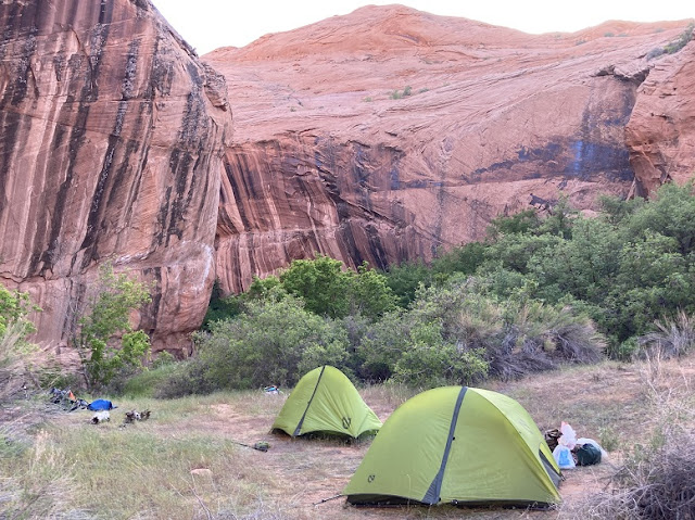
PICTURED BELOW: Our camp within Fifty Mile Creek, directly across the creek from a small alcove/cave and an arch with pictograph panels underneath it.
PICTURED BELOW: One reason I picked this spot to set up camp was because of it's closeness to this nice small pool in Fifty Mile Creek. For the most part in this upper part of the canyon, the creek was a little intermittent.
PICTURED BELOW: Petroglyph panel near our camp
PICTURED BELOW: Petroglyph panel near our camp
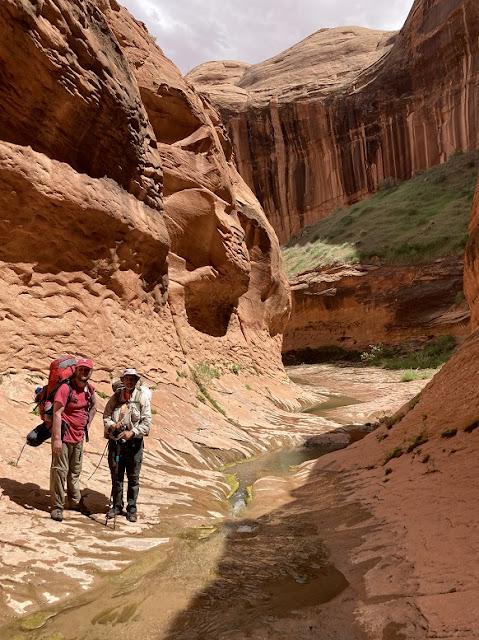
PICTURED BELOW: James in the lower Fifty Mile Creek narrows
PICTURED BELOW: In a deep alcove, lower Fifty Mile Creek narrows
PICTURED BELOW: James in the lower Fifty Mile Creek narrows
PICTURED BELOW: 'Vintage' 1960s plastic recliner and a clue that we're getting close to Lake Powell within Fifty Mile Creek. I could only guess what decade this fell off someone's boat and sank to the bottom of what used to be a much larger and fuller Lake Powell that once occupied this portion of Fifty Mile Creek
PICTURED BELOW: Visible white 'bath tub ring' of what, many years ago, had been the waterline of Lake Powell at "full pool" within Lower Fifty Mile Creek. You can also see the thick banks of fine grained Colorado River sand deposited at the bottom of Lake Powell when it stretched this far into Fifty Mile Creek. The creek has cut a new channel through these deposits.
PICTURED BELOW: We reached Lake Powell, backed up into Lower Fifty Mile Creek, marking the end of our exploration
PICTURED BELOW: Shells of the invasive mussels in the lake that litter the sand where Fifty Mile Creek met Lake Powell.

PICTURED BELOW: James in the lower Fifty Mile Creek narrows
PICTURED BELOW: James in the lower Fifty Mile Creek narrows
PICTURED BELOW: Waterfall in Lower Fifty Mile Creek
PICTURED BELOW: Waterfall (& me) in Lower Fifty Mile Creek
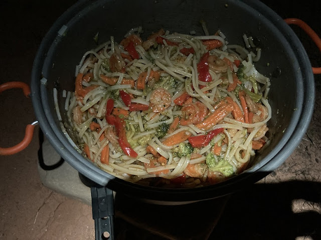
PICTURED BELOW: Dinner I made at our Fifty Mile Creek camp (It was a combination of Thai rice noodles with shrimp, vegetables and red bell pepper I dehydrated at home. The sauce was a mixture of oyster sauce, soy sauce, rice vinegar, powdered ginger and brown sugar I mixed up at home & put in a small bottle).
PICTURED BELOW: The steep sand slide we used as an exit to Fifty Mile Creek. It does not look that steep in this photo, but it was. On the way up I would sink about half way up to my knee in the soft sand with each step and slide back down. So on the steepest portion of the sand slide I actually pulled my pack up with a rope so I could make better progress climbing up the thing. It was exhausting, but worth the effort as a short cut to get over to Davis Gulch and complete a 'loop' hike over four days.
PICTURED BELOW: James (bottom left) finding a route up a rock fall to get around a cliff and actually get up on the sand slide. The start of the sand slide is seen at the upper right
PICTURED BELOW: Looking back down at Fifty Mile Creek from the top of the rockfall/sand-slide we used as an exit.
PICTURED BELOW: Waiting for the satellite phone to get a signal. James was anxious to check in with his wife.
PICTURED BELOW: James and I took a break before the cross country segment across sandy benches & slickrock between Fifty Mile Creek and Davis Gulch
PICTURED BELOW: Me on the cross country segment between Fifty Mile Creek and Davis Gulch. I had added a way point to my map that marked the break in the canyon wall that was an entry into Davis Gulch, then took compass bearings about every quarter mile to hit that point. My cross country navigation thankfully hit the bullseye, as we walked right to the entry point into Davis Gulch.
PICTURED BELOW: James on a slickrock section - near the entry to Davis Gulch
PICTURED BELOW: Our Davis Gulch camp, located right near where we entered the canyon
PICTURED BELOW: James fetching water at our Davis Gulch camp
PICTURED BELOW: Dinner I made for our first night in Davis Gulch (It's chicken and mango in a curry sauce with rice. I made up the curry sauce mix using a lot of spices at home, putting them in a zip lock bag. The mangos were bought dried. I dehydrated the chicken at home. The rice was instant boil in a bag brown rice)
PICTURED BELOW: Heading up Davis Gulch. There were some benches on the sides of the canyon, which made the going easier, but the bottom of the canyon was choked full of thick, tall brush and bamboo that covered a small stream. It made for very slow and exhausting progress most of the time.
PICTURED BELOW: The thicket we had to hike through at the bottom of Davis Gulch much of the time while heading up canyon.
PICTURED BELOW: James in Davis Gulch
PICTURED BELOW: Me in Davis Gulch
PICTURED BELOW: A gorgeous waterfall and pool near our camp in Davis Gulch
PICTURED BELOW: Me cooling off in the pool. It was about waist deep, too shallow for a swim.
PICTURED BELOW: The dinner I made for our second night in Davis Gulch - spaghetti. (I used a cheap spaghetti sauce mix, then added a small tube of tomato paste, sun dried tomatoes and sliced pepperoni)
PICTURED BELOW: James exiting Davis Gulch. You can see the remnants of the corral built by Everett Ruess, as this area was his last known camp before he disappeared in 1934. You can Google "Everett Ruess" to find out more information about his famous short life and disappearance.
PICTURED BELOW: Me - heading cross country from Davis Gulch back to the car. Once again I navigated best I could using compass bearings with Fifty Mile Point, Cave Point and the "Soda Slide" in the distance also as reference points. The trick was that I wanted to angle the best I could towards the car we had left near cave point, but not angle too close towards the deep section of the Soda Fork and South Fork of Fifty Mile Canyon that we would not be able to cross.
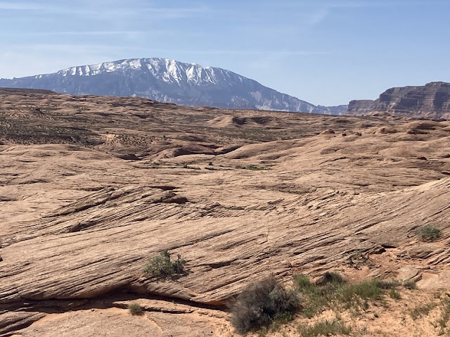
PICTURED BELOW: Miles of open slick rock terrain with the snow capped Navajo Mountain in the far distance (seen on the way from Davis Gulch back to the car).
PICTURED BELOW: James walking a portion of Hole in the Rock Road to get back to the car at Cave Point.
Map of Willow Gulch & Forty Mile Gulch
PICTURED BELOW: Pizza from Escalante Outfitters we enjoyed while boondocking at the "Sooner Rocks" Area on Hole in the Rock Road the night of May 2nd. Before James and I headed off to explore Fifty Mile Creek and Davis Gulch I had asked Matt if he could pick up some pizza from Escalante Outfitters on his way from Denver to have for dinner when he joined up with us. The man came through. Due to the hour and a half slow drive down Hole in the Rock Road from Escalante, the pizza wasn't very warm, but who could care. I'm glad I didn't have to bust out the freeze dried stew brought as a back up if he forgot or didn't feel like stopping in Escalante.
PICTURED BELOW: Matt ready to tackle Willow Gulch - parked on the Sooner Bench, off Hole in the Rock Road. The Straight Cliffs are in the background
PICTURED BELOW: Petroglyphs located in a tributary canyon that feeds into Willow Gulch
PICTURED BELOW: Me and part of the petroglyph panel
PICTURED BELOW: Petroglyphs located in a tributary canyon that feeds into Willow Gulch
PICTURED BELOW: Willow Gulch
PICTURED BELOW: Matt & James in Willow Gulch
PICTURED BELOW: Matt in Willow Gulch
PICTURED BELOW: The longest & deepest pool we encountered on the whole trip, located near the confluence of Willow Gulch and Forty Mile Canyon. The pool was about 40 yards long and had a very deep/soft muddy bottom, like quicksand, so you couldn't stay still. The water came up to my armpits. But I actually enjoyed this pool & found the cool water refreshing on the warm day. This also shows why good dry bags are a must if you want to explore these canyons.
PICTURED BELOW: Willow Gulch camp. An interesting alcove/cave (seen at right) was located across the creek
PICTURED BELOW: Kitchen at Willow Gulch camp
PICTURED BELOW: My tent, Willow Gulch camp
PICTURED BELOW: James, Willow Gulch camp
PICTURED BELOW: James and Matt in the cave/alcove located at our Willow Gulch camp
PICTURED BELOW: Dinner I made for our first night in Willow Gulch (store bought boxed seasoned pasta salad with sun dried tomatoes and shrimp & broccoli I dehydrated at home added)
PICTURED BELOW: James and Matt at the confluence of Willow Gulch and Forty Mile Creek
PICTURED BELOW: Matt in Forty Mile Gulch
PICTURED BELOW: Matt in Forty Mile Gulch narrows
PICTURED BELOW: James in Forty Mile Gulch narrows
PICTURED BELOW: Waterfall in Forty Mile Gulch narrows
PICTURED BELOW: James in Forty Mile Gulch
PICTURED BELOW: Lunch break in Forty Mile Gulch
PICTURED BELOW: Dinner I made for the second night at Willow Gulch camp (store bought tortilla soup mix with chicken and black beans I dehydrated at home added)
PICTURED BELOW: Hiking out of Willow Gulch
PICTURED BELOW: Broken Bow Arch (& me) within Willow Gulch
PICTURED BELOW: Broken Bow Arch within Willow Gulch
PICTURED BELOW: Main Street (Highway 12) in Escalante Utah
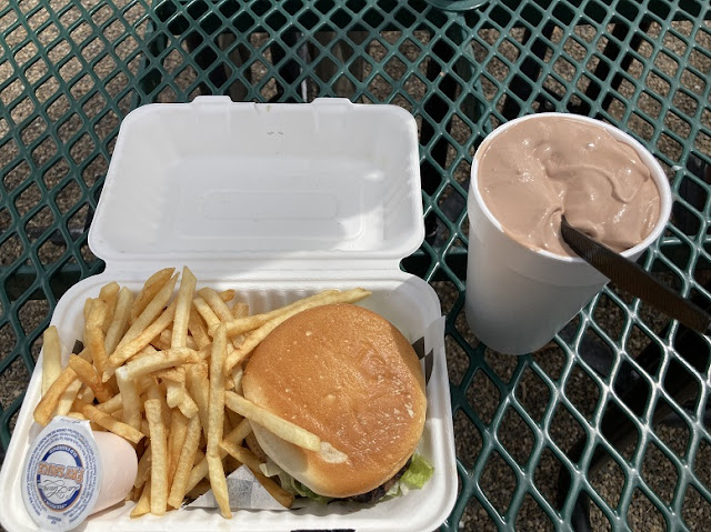
PICTURED BELOW: We grabbed a late lunch at Nemo's burger stand in Escalante, Utah on the way out.


